2020 Iowa Derecho
A Personal Story on that August Day
On August 10, 2020, one of the costliest thunderstorm weather events in U.S. history impacted most of the state of Iowa. Particularly hard hit was Cedar Rapids, where winds were estimated to be as high as 140 mph, the highest winds ever recorded during a derecho event. These winds are equivalent to a Category 3 or 4 hurricane—the only difference is this storm did not originate over the ocean.
I was working from home and was aware of the potential of severe weather that day. It was around lunchtime when I started to hear how strong the winds were in Des Moines, Iowa, I turned on live coverage from the local news as the storm moved into eastern Iowa. Checking the radar on my phone, I saw a frightening wall of red coming our way. As reports on TV came in of winds over 90 mph and gusts up to 100 mph, I knew this was becoming life-threatening as it moved closer to Cedar Rapids. I left my 3rd floor apartment and went to the lowest level of the building.
The tornado sirens began sounding at 12:18 pm in Cedar Rapids. The strong winds started blowing around 12:34 pm. What ensued next was something I'd never thought I'd witness in my entire life. At 12:46 pm, I watched power flashes, large tree limbs, parts of the apartment building, rain and leaves move past the mailroom window at mind-blowing speeds. The strong winds lasted for 45 minutes.
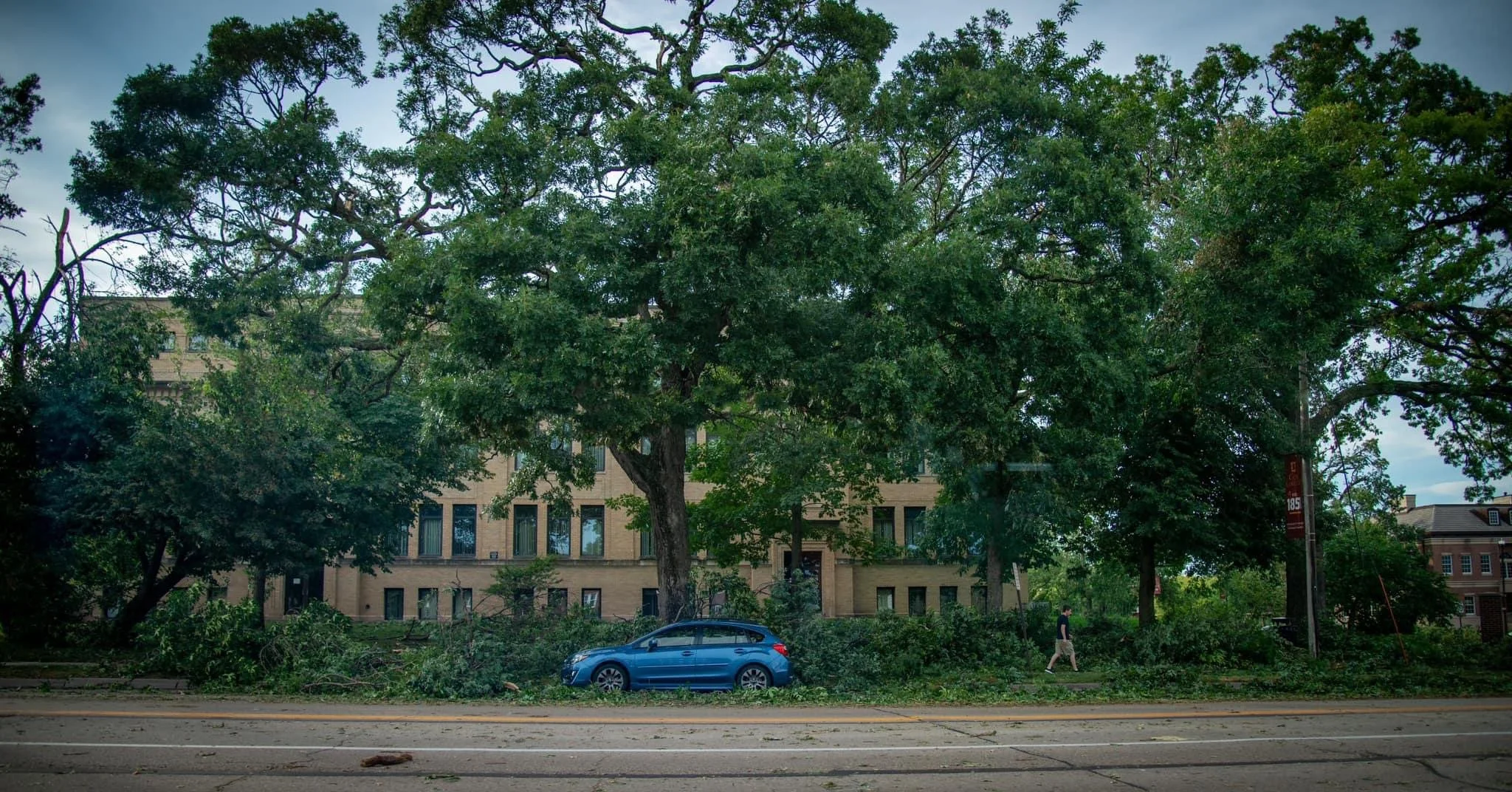
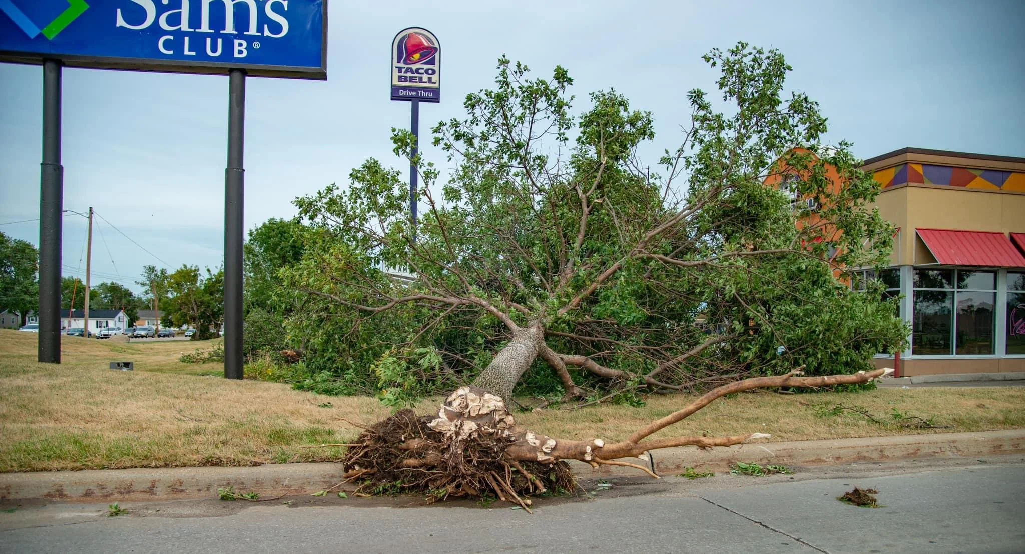
After it was safe to assess the damage to the apartment property, the chilling sound of emergency sirens filled the air for hours. The majority of the city and many parts of the state were without power. Trees were down everywhere, most snapped in half. My parents had a generator, so I left to stay at their place for several days. Upon driving to the north side of Cedar Rapids, I began to grasp the gravity of how devastating this storm was. Stops signs bent over at 90 degrees, every business sign was destroyed, trees on houses, completely impassable roads, semi trucks and railroad cars blown over, buildings severely damaged or destroyed, and once I turned onto the street I grew up on, almost every tree was gone. The damage done in 45 minutes left many without power and internet, many for days, others for weeks, and the damage done to the landscape will be noticeable for decades.
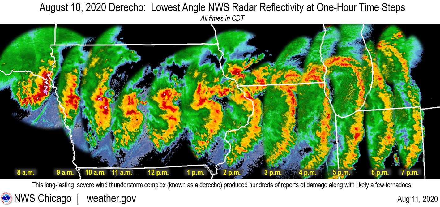
Image by weather.gov
The Impact to Our Trees
Over the next several months, the gut-wrenching reality of a once mature tree-filled city was noticeably gone. Entire tree-filled parks now looked like barren deserts. Truckloads of fallen trees began to be the most common site on our city streets, and walls of tree debris lined many neighborhoods. The initial cleanup effort took two years. The process of repairing remaining damaged buildings and trees is still ongoing.
The city of Cedar Rapids estimates up to 100,000 trees were damaged or destroyed, resulting in 65% of our tree canopy gone. Across the state, 4.4 million trees were destroyed. The latest estimate for damage from the derecho is $11.5 billion.*
One of my favorite quotes is, “An infinity of forests lies dormant within the dreams of one acorn.” Imagine the impact one acorn can have on our city. I hope The Oak Vessel will inspire the community to plant more trees. Fortunately, there are oak trees still standing in Cedar Rapids and the surrounding communities. These oaks drop acorns in the fall, which gives us the opportunity to begin restoring our canopy for future generations. The mighty oak, indeed, does live within the acorn.
Oak trees support more life forms than any other North American tree. Trees give us oxygen to breathe, they mark the seasons, and beautify our neighborhoods. The more trees and landscaping a city has, the more people will likely engage with public infrastructure and local businesses. Trees reduce stormwater runoff, erosion, and pollution in our waterways, and can reduce the effects of flooding.
Let's start planting trees today—tomorrow will thank us.
—Nate Collins
“The true meaning of life is to plant trees, under whose shade you do not expect to sit.” — Nelson Henderson
*Sources: noaa.gov, cedar-rapids.org/derecho. Gallery Below by Louis M. Collins